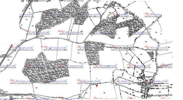
logo

Noakes Grove History 400 - 2009 AD

This month's newsletter .... Menu - for other pages

gaffer
Please donate. Walden Countryside creates public access nature reserves and promotes the conservation of traditionally managed countryside in north Uttlesford


.

In 1605 an inventory was made of all the fields and woods in the Saffron Walden area. The original has been lost but a hand-written translation, made around 1750, exists in the Saffron Walden Town Library. Here is what it says about parts pf Noakes Grove:

1605 fields

The above says:

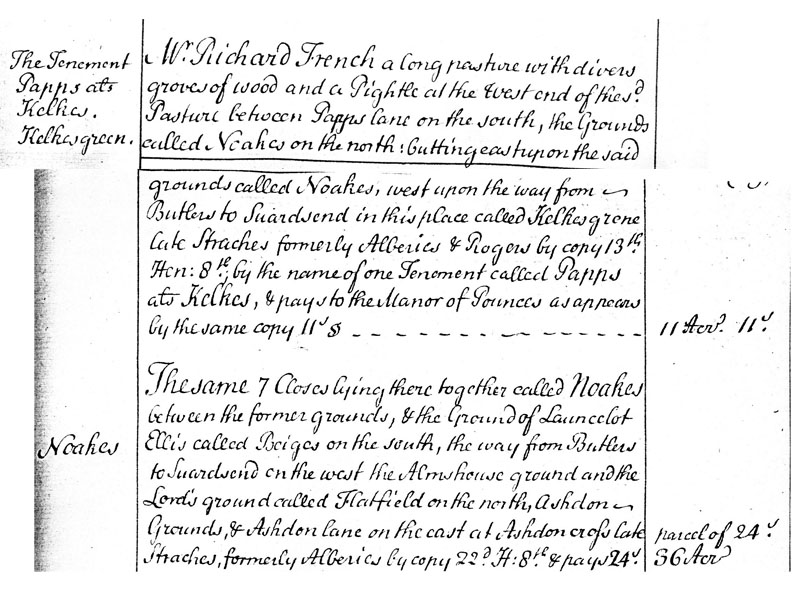
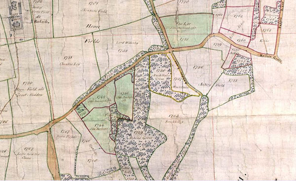
The Tenement Papps ats Kelkow. Kelkowgreen.

Mr. Richard French a long pasture with divers groves of wood and a Pightle at the west end of 
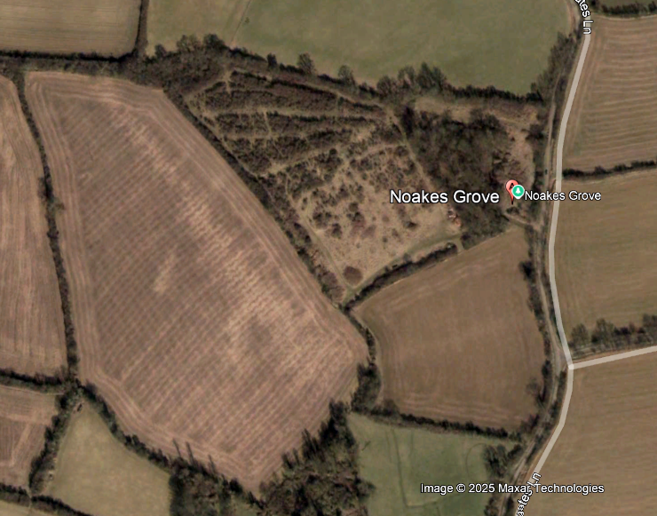
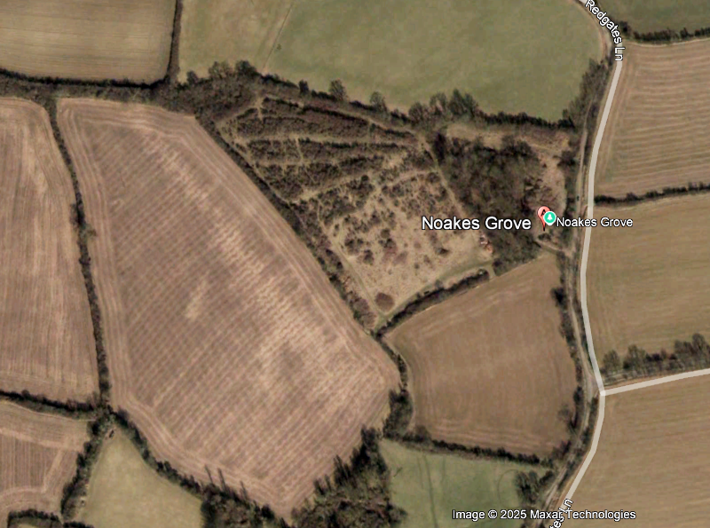
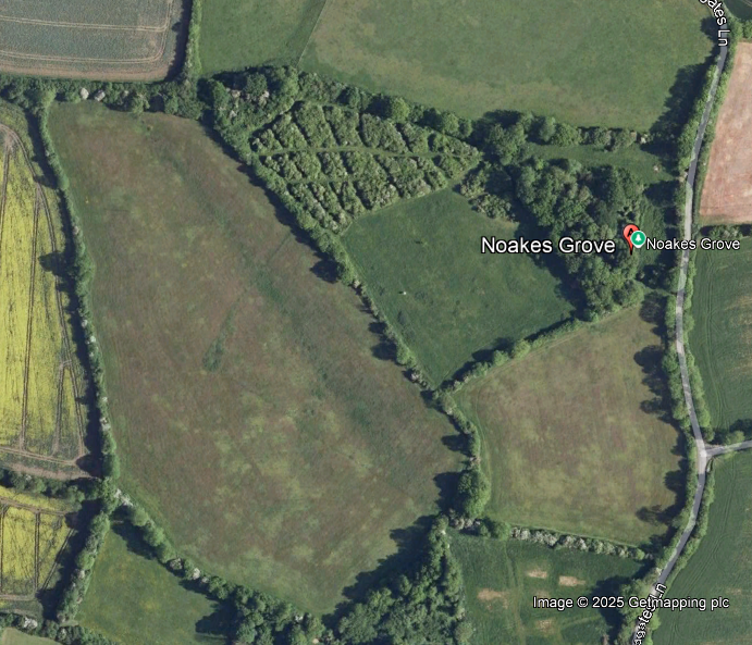
the? Pasture between Pappas lane on the south, the Grove called Noakes on the north butting east upon the said grounds called Noakes, west upon the way from Butlers to Siwardsend in this place called Kelkow grene late Straches formerly Alberies & Rogers by copy 13th Hentry 8th by the name of one Tenement called Papps at Kelkes, payes to the Manor of Pounces as appears by the same copy II's

11 Acres 11

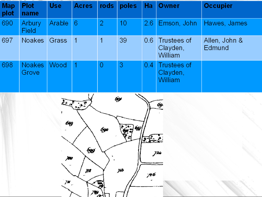
The same 7 Closes lying there together called Noakes between the former grounds, & the ground of Launcelot Ellis called Boiges on the south, the way from Butlers to Siwardsend on the west the Almshouse ground and the Lord's ground called Flatfield on the north, Ashdon Ground, & Ashdon Lane on the east at the Ashdon croft late Stracher, formerly Alberies by copy 22nd JL? 8?? and pay 24. parcel of 24 36 acres


In 1758 two very similar maps were made showing details of every field: one map covering the whole parish of Saffron Walden, including Sewards End (held by Essex Record Office but a photographic digitised copy available at the Saffron Walden Town Library) , and the other the estate of St Aylots (available online from the Essex Record Office)

 
noakes 1758


The map (left) is from the St Aylots survey and shows Noakes Grove has changed very little. The wide hedge on the north-east, south-east and south-west of Arbery Field is the only difference.Most of the writing on the map runs north - south

Tithe map - about 1840

This shows the owners and occupier of each parcel of land in what is now Noakes Grove.

Note different farmers farm Arbury and Noakes Fields.

tithe map

1877 Map

This is the first edition Ordnance Survey 25 inch to a mile map published in the 1877

Noakes Grove had the same hedges as now but to the west of Noakes Grove most of the mapped hedges have bee removed to create large fields.

Noakes & Slade Valley

1949

1949

Note hedge now removed


1988

1988

Note white Noakes field - building waste dumped


2000

2000

2003

2003

2006

2006

2009

2009

Hattie

Arbery Fieldd was known as the Fete Field in the 1970s & 1980s

Hattie Jaques attends a village fete.

Reeves Brothers The Reeves brothers (numbers 1, 3 & 5 from the left. The farmed Noakes Grove and all the rest of Sewards End Farm until the 1970s
cross The ashes of all three brothetrs were buried together in a corner of Noakes Grove wood in 1974


Top of document

Copyright 2025
Organic Countryside Community Interest Company
Trading as Walden Countryside
Company number 06794848 - registered in England
VAT No: 947 3003 317

Updated 1 August 2025